Rotorua's urban expansion has always wrestled with its underlying geology: the town sits squarely inside the Taupo Volcanic Zone caldera rim, where the Rotorua Ignimbrite and overlying Mamaku Plateau rhyolites create highly variable foundation conditions. As the city spread southward toward the Whakarewarewa geothermal field and east into the lake sediments of Lake Rotorua's former shoreline, engineers began encountering loose pumice layers, hydrothermal alteration zones, and shallow water tables that made conventional borehole-based site classification unreliable. The Rotoehu ash and Kaharoa tephra deposits, mapped extensively across the Bay of Plenty region, exhibit rapid vertical stiffness transitions that only surface-wave methods can resolve without disturbance. Our MASW surveys provide the shear wave velocity profiles required under NZS 4203 to assign site subsoil class across this complex volcanic landscape, while also feeding the seismic microzonation studies that Rotorua Lakes Council increasingly demands for subdivisions on the caldera margin.
In Rotorua's loose pumice and hydrothermal deposits, MASW-derived Vs30 values regularly fall between 180 and 320 m/s, placing sites firmly in Class C or D under NZS 1170.5.
Technical details of the service in Rotorua
Procedure video
Critical ground factors in Rotorua
A recurring mistake on Rotorua construction sites is relying solely on SPT N-values or Scala penetrometer tests to estimate site class, without verifying the small-strain shear wave velocity. In the non-welded ignimbrite and coarse pumice sands found across the Fenton Street corridor and the Tihi-o-tonga area, SPT blow counts often overestimate stiffness because particle crushing during driving absorbs energy and produces misleadingly low N-values, while the intact small-strain Vs remains considerably higher. Conversely, in the hydrothermally altered ground near the Whakarewarewa thermal reserve, hot acidic fluids have leached the cementation from the ignimbrite matrix, leaving a weak, friable fabric that records a low Vs despite a deceptively competent appearance in the drill core. These conditions can shift a site from Class C to D or even D to E when the 30-metre Vs30 average is computed, altering the design base shear by 30 to 50 percent. A liquefaction assessment that uses CPT-based triggering curves without the correct overburden-normalised Vs can also underestimate the cyclic resistance of the Rotorua pumice sands, a material known to exhibit transitional behaviour between sand-like and gravel-like liquefaction response.
Our services
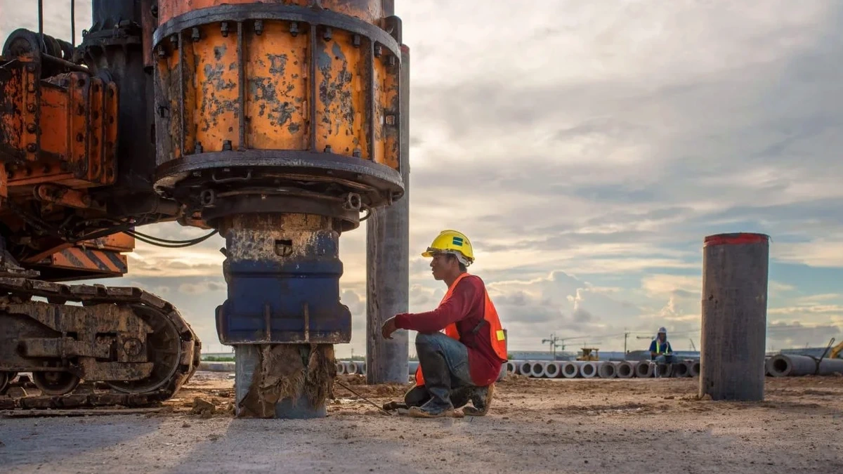
The MASW field campaigns in Rotorua are designed to handle the specific noise and access challenges of the geothermal environment. Each survey package includes the final Vs30 contour map and the NZS 1170.5 site class letter for direct use by the structural engineer.
MASW 2D Profile for Subdivision Earthworks
Multi-line MASW arrays spaced at 25-metre intervals across the proposed lot layout, with Vs30 interpolation to produce a continuous site-class map. Required by Rotorua Lakes Council for resource consent on greenfield developments over buried lake sediments.
Downhole Seismic Calibration in Ignimbrite
Combined downhole survey in a cased borehole to calibrate the MASW dispersion inversion against interval velocities in the welded Rotorua Ignimbrite. Essential when the temperature gradient exceeds 30°C/km and alters the dynamic properties of the saturated tuff.
Vs30 Testing for Liquefaction Triggering
Vs30 profiling integrated with CPTu data to compute the corrected cyclic resistance ratio of the Rotorua pumice sands. Uses the Kayen et al. (2013) Vs-based triggering curve calibrated for New Zealand volcanic soils.
Questions and answers
How much does a MASW / Vs30 survey cost for a standard residential site in Rotorua?
For a typical residential lot requiring two to three MASW spreads to establish the Vs30 profile, the cost ranges from NZ$2,690 to NZ$5,010 depending on array length, number of measurement locations, and whether a downhole calibration is also needed. Sites with difficult access on steep ignimbrite slopes or near thermal ground may require additional hand-cleared line preparation.
What site class do most Rotorua soils fall into under NZS 1170.5?
The majority of Rotorua's urban area falls into Site Class C (shallow soil, 150 < Vs30 ≤ 300 m/s) or D (deep or soft soil, Vs30 ≤ 150 m/s). The lake sediment areas around Sulphur Bay and the Ngapuna industrial zone frequently classify as Class D or even E, while the ignimbrite plateaus near Western Heights and Pukehangi can reach Class B where the rock is shallow and unwelded.
How does geothermal activity affect the MASW measurement?
Geothermal activity introduces three effects: elevated ground temperatures that reduce the shear modulus of saturated tuff and silt, high ambient noise from steam vents and mud pools that require longer shot stacking, and variable groundwater chemistry that can alter the Poisson ratio. Our processing workflow applies dispersion curve filtering to isolate the fundamental Rayleigh mode even in noisy geothermal environments.
Can you perform MASW without drilling a borehole?
Yes, the MASW method is entirely non-invasive and does not require any drilling. The geophones are planted at the surface along a straight line, and the energy is generated by a sledgehammer impact. For Rotorua sites where the depth to the ignimbrite basement must be confirmed, we often recommend pairing the MASW with a single CPT sounding to anchor the velocity inversion.
What is the difference between MASW and seismic refraction for Rotorua volcanic soils?
Seismic refraction relies on a velocity model that increases with depth, which fails in Rotorua where loose pumice often overlies stiffer ignimbrite or where hydrothermal alteration creates low-velocity zones beneath competent crust. MASW uses surface-wave dispersion, which does not require a layered velocity increase, making it the preferred method for the complex stratigraphy of the Taupo Volcanic Zone.